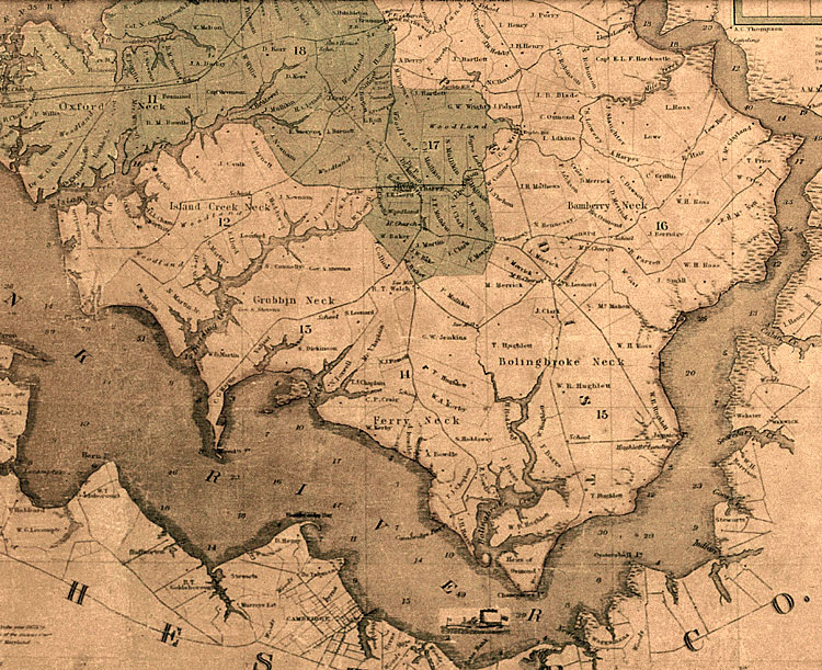
"Map of Talbot Co., Md. with Farm Limits
1858" by William Dilworth. This is the first map
of the county to note the names of property owners,
so it is a valuable reference tool. Only a dozen or
so copies of this map are known and many are in poor
condition. This one is used courtesy of the Maryland
Room of the Talbot Co. Free Library.
|