 |
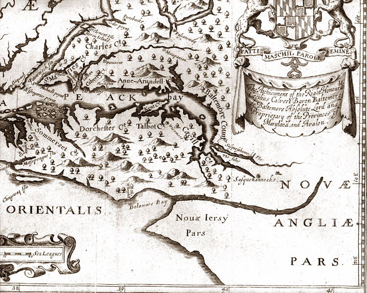
Detail of "Nova Terra-Maria Tabula" (New Map of Maryland)" by John Ogilby in 1671. This was the first map to show any of Maryland's counties including Talbot which had been established in 1661. No towns are shown and Trappe wouldn't exist for another hundred years. Maps were becoming more accurate. There were only four counties on the Eastern Shore then. Even though parts of Dorchester, Talbot and Kent are distorted, they are correctly shown as having peninsulas instead of being islands as they are on the John Smith map. The mouth of the Choptank River might be here too, it is hard to tell. There are still some mountains shown in Delmarva. Some earlier maps had shown a whole mountain range running down the Eastern Shore. |