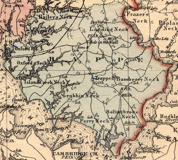
  This is a detail of Trappe District from Simon J. Martenet's Map of Maryland Atlas Edition from 1866. The map is hand colored and very accurate locating schools, churches and even the Alms House near Hole in the Wall. Hole in the Wall is now named Hambleton. The "Col. Ch" shown just south of Trappe was then the African M.E. Church which became Scotts M.E. Church in 1869. Although Oxford is technically part of Trappe District as shown on this map, it has its own rich history and for historical purposes is considered a separate area. |