 |
|
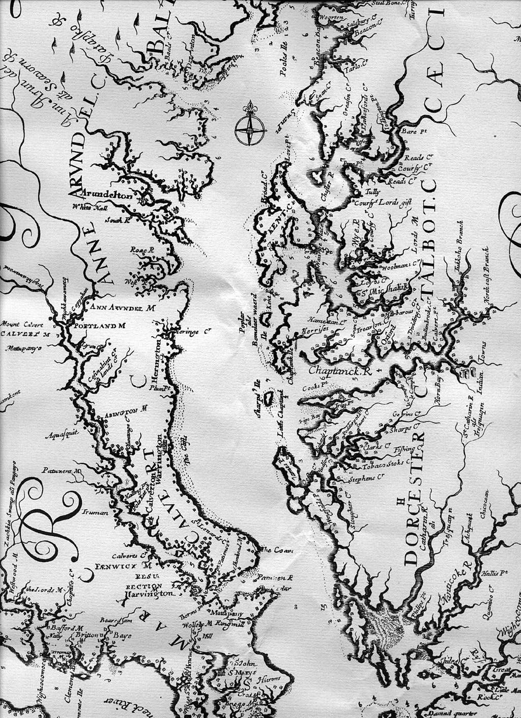
"A detail of the Chesapeake Bay from "Virginia and Maryland As Is Planted and Inhabited this present Year 1670 Surveyed and Exactly Drawne by the Only Labour and Endeavour of Augustin Herrman" published in London in 1673. This is a superb map measuring 30 x 35 inches. It is the first map to show the Choptank River, Dividing Creek, Bullenbrook's Creek and Calvert Pt. (now Chancellor's Pt.). Note that it even gives soundings for the Choptank River. This is the best map done of the Bay since John Smith's map of 1612 and one that map makers would copy for the next century or so. As a reward for his efforts, Hermann was given a plantation in Cecil Co. There are only about 5 originals in existence. This is taken from a full sized copy done around 1970. " |