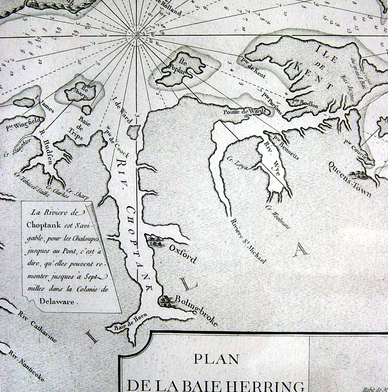
 The sailing directions for the Choptank river read: "The Choptank River can be navigated by boats up to the bridge, ie., they can go seven miles up into the Delaware Colony" (translation by Tom Edwards). |
|
The sailing directions for the Choptank river read: "The Choptank River can be navigated by boats up to the bridge, ie., they can go seven miles up into the Delaware Colony" (translation by Tom Edwards). |