 | ||
|
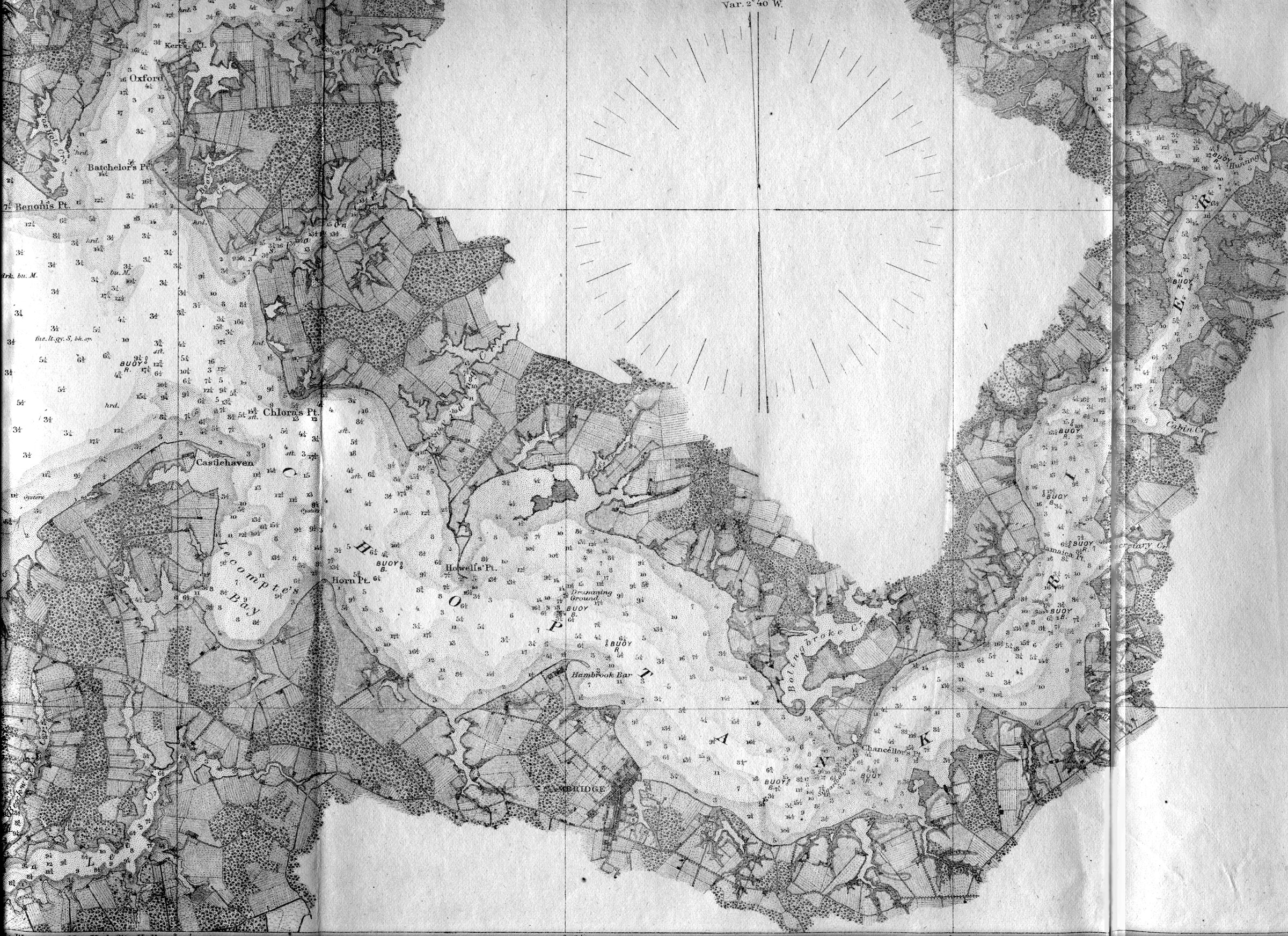
Detail from Chesapeake Bay Chart No. 32 From Magothy River to Choptank River from a Trigonometrical Survey under the Supervision of F.R. Hassler and A.D. Bache; Washington D.C. 1862. This superb chart shows great shoreline detail including fields and forests and buildings that a captain might see from his ship and even gives water depth. This close-up shows the Choptank River and the edge of Trappe District. Note that Riker's Island at the mouth of Bolingbroke Creek is shown on this chart as being still joined to the mainland by a thin strip of land which later eroded away creating the island. It was bought by John Riker in 1883 and was the site of Camp Maryland, a boys camp in the 1930s "The Soundings are expressed in feet to 18 feet or within the dotted surfaces beyond them in fathoms, and show depth at mean low water- the plane of reference." A fathom equals 6 feet or 1.83 meters. |